
Standard GNSS puts a UAV within a few metres of where it thinks it is. For flying a field, that’s fine. For mapping one, spraying one, or inspecting an asset you’ll come back to, a few metres isn’t good enough. Every pass lands somewhere slightly different and the data won’t line up.
Quick answer: Standard GNSS puts a UAV within a few metres, which is fine for flying a field and not fine for mapping or spraying one. RTK compares the aircraft’s satellite measurements against a reference whose position is already known and lands you at a couple of centimetres. A local base station is more stable because fewer things can fail between the reference and the aircraft, and it usually needs a baseline of a few kilometres. Network RTK removes the base but needs 4G or 5G coverage at the site. Both still depend on a clear sky view, because RTK corrects systematic error, not a blocked or reflected signal. Worth it when results must line up between visits. See the stack integration guide and the survey configuration guide.
| Question | Local base station | Network RTK |
|---|---|---|
| Accuracy in good conditions | A couple of centimetres | A couple of centimetres |
| Stability | More stable, fewer failure points | Depends on the correction service |
| Setup | You place and power the base | No base, but needs a data subscription |
| Coverage requirement | Baseline of a few kilometres | 4G or 5G at the site |
| Fails when | You work too far from the base | There is no cell signal |
RTK fixes that by comparing the aircraft’s satellite measurements against a reference whose position is already known. There are exactly two ways to get that reference, and picking between them is the decision this article is about.
What RTK fixes, and what it does not
RTK corrects the systematic errors in GNSS: ionospheric delay, satellite clock error, and the slow drift of the satellite constellation. What it won’t fix is a bad sky view, multipath bouncing off buildings, or a gimbal you never calibrated. A clear view of the sky is still the foundation, and RTK builds on top of it.
And RTK is about repeatability as much as absolute accuracy. Two flights over the same field with RTK land on the same grid. Without it, they don’t.
How a local base station works
A base station is a second GNSS receiver sitting on a known point. It watches the same satellites the aircraft does, works out the error, and radio-links that correction to the aircraft in real time. Because the correction is measured from a nearby point, it’s highly accurate inside the base’s coverage radius, typically a few kilometres for centimetre-level work.
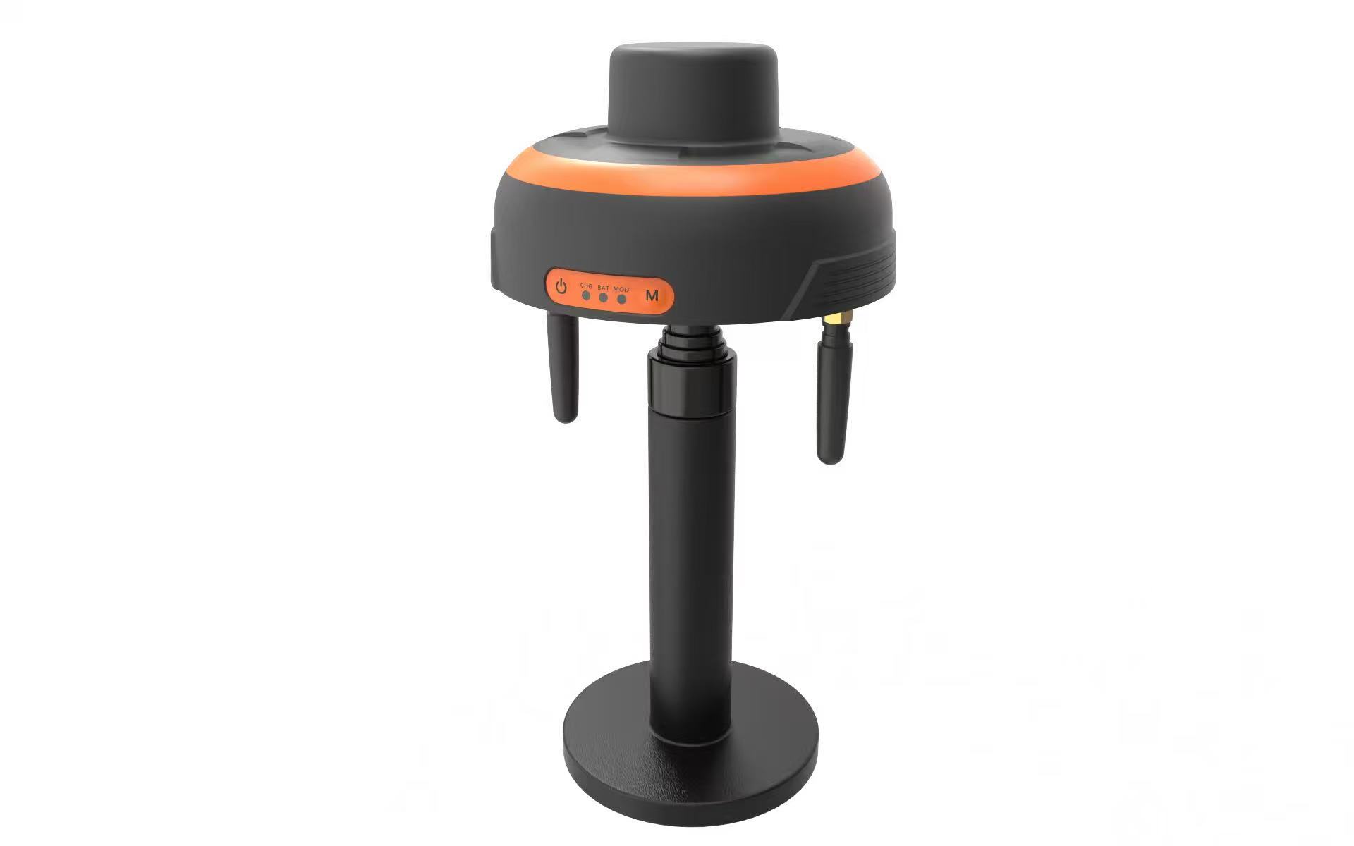
The Skydroid RTK base station is the portable form of this. Place it, power it, let it settle, and it broadcasts corrections to the aircraft. No subscription, no network, no dependence on cell coverage.
The trade is coverage. Fly too far from the base and the correction degrades with distance. You also have to set the base up at every site, and you have to know its own position.
How network RTK works
Network RTK swaps your base station for corrections you download over the internet, from a service that runs a network of reference stations. The aircraft, or its companion computer, pulls the correction stream over 4G or 5G and applies it exactly the way a local base’s corrections work.
The upside is coverage and convenience. No base to carry, no site setup, and the corrections hold up over a wide area. The downside is just as clear. You need data coverage at the site, a subscription or service account, and there’s a few seconds of latency in the correction stream. Down in a valley with no signal, network RTK simply doesn’t work.
Accuracy and fix time compared
In good conditions both methods reach the same couple-of-centimetre order of accuracy. The difference shows up in the corners. A local base with a clean sky and a short baseline is the most stable, because nothing sits between the two receivers that could fail. Network RTK depends on the link staying up, and the fix time at the start of a flight can run longer while the stream establishes.
Distance from the reference matters for both. A local base loses accuracy as the baseline grows. A network service manages that for you by picking the nearest reference, but only where coverage exists.
Cost, setup and the mission type
Survey and mapping. Either works. Network RTK is convenient over large areas with coverage. A base station is more reliable and repeatable on a fixed site, and it takes the subscription off the bill.
Precision agriculture. Repeatable passes matter more than absolute coordinates, so a base station on the field edge fits naturally, and it keeps working where rural data coverage is thin.
Inspection. If the asset is fixed and you revisit it, a base station gives you consistent positioning across visits. If you’re moving between many sites, network corrections save setup time.
Remote sites. No data coverage means a local base, full stop.
How positioning gets combined with the gimbal and autopilot on one airframe is covered in RTK, gimbal and avionics integration, and the hardware lives under Avionics System. The wider subsystem picture is in the UAV avionics guide.
Frequently asked questions
Which is more accurate, a base station or network RTK?
In good conditions they are equivalent at a couple of centimetres. A local base is more stable, because fewer things can fail between the reference and the aircraft, as the stack integration guide sets out.
Can I use network RTK with no cell signal?
No. Network corrections arrive over a data link. With no coverage you need a local base station.
Do I still need a good sky view with RTK?
Yes. RTK corrects systematic error, not a blocked or reflected signal. A clear sky view is still the foundation.
How close does the base have to be?
Usually within a few kilometres for centimetre-level work. Accuracy falls off as the baseline grows.
Is RTK worth it for inspection?
When the same asset gets revisited and results have to line up between visits, yes. For one-off visual inspection, standard GNSS is usually enough, which is the argument in our survey configuration guide.
Tell us the site, the accuracy you need and whether you have data coverage, and we will match the receiver and correction method around it. The range is on our Skydroid systems page, with the configuration view in our survey and mapping guide.



Pingback: UAV Avionics Guide: Control, Video, RTK and Gimbal Systems
Pingback: UAV Applications Guide: Agriculture, Inspection and Survey